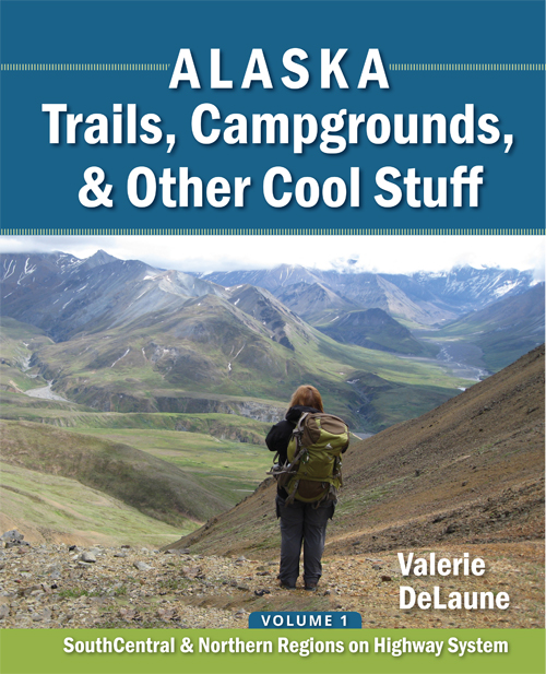
Denali Park Road
MP 0
| Denali National Park Road
Intersection with Parks Highway MP 237.3
| Access: Turn west into the Denali National Park main entrance. The entrance complex, which is just off the Parks Highway, contains the Visitor Center, the Wilderness Access Center (where the buses leave from), a post office, a small store, showers/RV dump station (which are purchased at the store), a campground, the sled dog kennels (used for patrolling the Park in winter), and trails. For most of the summer you can only drive into the Park for 14.5 miles to the Savage River, unless you have a campsite reserved at Teklanika River Campground. To get past Savage River, you must board a bus (see the Denali Park website). NOTE: you will not have cell service much past the entrance to the Park, and there is no gas station inside the Park. The nearest gas is located just north of the Park Entrance.
Lat N 63⁰ 43.713’ Long W 148⁰ 53.178’ Elevation 1569’
| Links: Denali Visitor Access Bus Information
Free Park Entrance Shuttle Buses
Downloads: |
MP .4
| Riley Creek Mercantile & Campground
| Access: Turn left for the campground, the Mercantile (store), showers and dump station. There is no gas here. The campground is open year-round. There is a connector trail from the campground leading over to the Visitor Center, or you can connect with the Triple Lakes Trail. See the download for Park Entrance Trails.
Lat N 63⁰ 44.007’ Long W 148⁰ 53.635’ Elevation 1618’ | Links:
Riley Creek Campground Reservations
Free Park Entrance Shuttle Buses
Downloads:
|
MP .7
| Wilderness Access Center
| Access: Turn right into the Wilderness Access Center and Backcountry Information Center.
This is where you catch the buses that go into Denali. NPS rangers are available to answer your questions, issue backpacking permits, and book Igloo and Sanctuary River Campgrounds.
Lat N 63⁰ 44.216’ Long W 148⁰ 54.216’ Elevation 1704’ | Links: Wilderness Access Center (Bus Depot)
Free Park Entrance Shuttle Buses
Downloads:
|
MP 1.4
| Denali Visitor Center
| Access: Follow the signs at the round-about to the Visitor Center.
This is a good place to get oriented to the Park, before proceeding to the Wilderness Access Center to board your bus into the Park. Several trails can be accessed from this parking lot. I have only highlighted the longer trails below; see the Park Entrance Trails download and other downloads for the full list of shorter trails.
Lat N 63⁰ 43.918’ Long W 148⁰ 55.017’ Elevation 1776’
| Links:
Free Park Entrance Shuttle Buses
Webcam - Visitor Center Bronze Grizzly
Downloads:
Entrance Area Photo with Trails Overlaid
|
MP 1.4
| Triple Lakes Trail
| Access: Follow the signs from the Visitor Center.
Distance: 9.5 miles to the Parks Highway. There are also side trails down to the lakes. Elevation Gain: 1000’ Difficulty: Easy-moderate with a steeper downhill section to get to the Parks Hwy Best Months: Year-round Valerie’s Rating: ❸ | Links:
Downloads:
Entrance Area Photo with Trails Overlaid
|
MP 1.4
| Mt Healy Overlook Trail | Access: From the Visitor Center, take the Taiga Trail for .5 miles, and look for the Mt. Healy Overlook Trail Junction.
Distance: 2.7 miles Elevation Gain: 1700’ Difficulty: Strenuous Best Months: Summer
Beautiful views. It is possible to continue past the end of the trail along the ridge toward Healy and descend in a few places, but this section is a route and not a trail. You should not attempt this route without good visibility and a topo map, and local advice. Valerie’s Rating: ❺ | Links:
Downloads:
Entrance Area Photo with Trails Overlaid
|
MP 1.4
| Rock Creek Trail
| Access: From the Visitor Center, take the Taiga Trail, and look for the Rock Creek Trail Junction at about .4 miles.
Distance: 2.4 miles to the Sled Dog Kennels Elevation Gain: 400’ Difficulty: Moderate Best Months: Year-round
I only give this a “3,” just because there are so many outstanding places to hike in the Park that provide much better views by comparison. Valerie’s Rating: ❸ | Links:
Downloads:
Entrance Area Photo with Trails Overlaid
|
MP 1.5
| Murie Science & Learning Center
| Access: Turn right into the Murie Science and Learning Center.
This Center functions as the main Visitor Center in winter. There are some winter trails that leave from here.
Lat N 63⁰ 43.986’ Long W 148⁰ 55.126’ Elevation 1789’ | Links: Murie Science and Learning Center
Free Park Entrance Shuttle Buses
Downloads:
|
MP 3.4
| Park Headquarters and Sled Dog Kennels
| Access: Turn left into the parking area and walk a short distance to the kennels (about 200 yards), or take the free courtesy bus from the Wilderness Access Center or Visitor Center. In winter, the Park road is only open to this point.
Lat N 63⁰ 43.290’ Long W 148⁰ 57.966’ Elevation 2030’
There are sled dog demonstrations here during the summer up to three times per day, but the dogs are available to see much of the time; check the open hours posted on the Park website. The kennels are well worth the stop before heading further into the Park. Valerie’s Rating: ❺ | Links: Free Park Entrance Shuttle Buses
Downloads:
Entrance Area Photo with Trails Overlaid
|
MP 12.6
| Mountain Vista & Savage Alpine Trails
| Access: Turn left into the Mountain Vista parking area.
Lat N 63⁰ 43.019’ Long W 149⁰ 15.190’ Elevation 2816’
Mountain Vista Trail: Distance: .7 miles RT for the interpretive loop, .9 for the river loop Elevation Drop: 72’ Difficulty: Easy Best Months: Summer
This loop starts near the parking lot restrooms. It’s a nice interpretive trail that explores one of the first visitor lodging areas in the early Park. Valerie’s Rating: ❹
Savage Alpine Trail: Distance: 4 miles to Savage River Loop Trail / free shuttle Elevation Gain: 1500’ Difficulty: Moderate/Strenuous Best Months: Summer
Walk to the Park road .1 mile and cross to the trailhead. I recommend starting from this end of the trail for several reasons: there is far more parking at the Mountain Vista Parking area, the incline is gentler from this end, and it’s easy to hop on the free shuttle on the other end and get back to your car here. You will need to tell the bus driver to pull into the Mountain Vista lot if you have left your car here. Valerie’s Rating: ❺ | Links: Savage River and Mountain Vista
Free Park Entrance Shuttle Buses
Mountain Vista Trail Conditions
Savage Alpine Trail Conditions
Downloads: Savage River Area Trails Descriptions
|
MP 12.6
| Savage Cabin Interpretive Loop
| Access: Turn left into the Mountain Vista parking area (see above).
Distance: 1 mile RT interpretive loop, .4 mile one-way to the cabin Elevation Gain: 82’ Difficulty: Easy Best Months: Summer
Walk to the Park road .1 mile and cross, and then take a left. If you want to do the interpretive loop, continue straight past the outhouses at .3 mile. If you just want to go to the cabin, turn right at the outhouses. An interpreter (employed by the bus concessionaire) is stationed here during some hours; they are willing to answer your questions if they don’t have a tour present. Valerie’s Rating: ❸ | Links: Free Park Entrance Shuttle Buses
Downloads: Savage River Area Trails Descriptions
|
MP 12.7
| Savage River Campground
| Access: Turn left into the campground. Summer only, open to RV’s and tents. Reservations are required.
Lat N 63⁰ 43.063’ Long W 149⁰ 15.378’ Elevation 2803’ | Links:
Savage River Campground Reservations
|
MP 14.5
| Savage River Loop Trail & Savage Check Station
| Access: On the right side of the road, there is a very small parking area before you cross the river. It is recommended that you take the free shuttle to get here instead, since parking is so limited.
Lat N 63⁰ 44.306’ Long W 149⁰ 17.507’ Elevation 2634’
Distance: 2.1 mile loop including the River Bar Loop Elevation Gain: 177’ Difficulty: Easy Best Months: Summer
Pretty loop on each side of the river bed. You can also access the Savage Alpine trail from this end, but I recommend starting from the Mountain Vista parking lot instead (see trail information at MP 12.6). The check station is as far as you can drive into the Park unless you are staying at Teklanika River Campground. Valerie’s Rating: ❺ | Links: Savage River and Mountain Vista
Free Park Entrance Shuttle Buses
Downloads: Savage River Area Trails Descriptions
|
MP 17
| Primrose Ridge Route
| Access: Just before the 17-mile marker, get off the camper bus in the parking lot with a restroom. Walk west .1 mile, and then on the north side of the road (across from a small turn-out) look for an unmarked path that leads up to the ridge. You can go either direction once you reach the ridge. You may also walk 2.4 miles from the Savage River check station, which is the terminus for the free shuttle from the Park entrance bus stops.
Distance: 1.5 miles to reach the ridge, then walk either direction Elevation Gain: 1350’+ Difficulty: Strenuous/Moderate Best Months: Summer
Stunning views, including Denali in the distance on a clear day. Valerie’s Rating: ❺ | Links:
Downloads: Primrose Ridge Route GPS Trail Map
|
MP 22.6
| Sanctuary River Campground
| Access: Left side of the road. Summer only, tents only. Advance reservations are NOT offered. Campsites must be booked in person at the Riley Creek Mercantile or Wilderness Access Center no more than two days in advance of the intended dates of stay. Access is by shuttle only – you cannot drive here. | Links:
|
MP 29.1
| Teklanika River Campground
| Access: Right side of the road. Summer only. You may drive your vehicle / RV, but you must reserve a minimum three-night stay, and your vehicle must remain in your campsite for the duration of your stay. Your vehicle can only leave your campsite when you are ready to travel back to the park entrance. (This rule does not apply during the Denali Road Lottery, typically held annually in mid-September.) Once parked, you can use the shuttle system to move around the Park. Tent campers using the park bus system are not subject to the 3-night minimum stay. | Links:
Teklanika River Campground Reservations
|
MP 30.2
| Teklanika Rest Area
| Access: Right side of the road.
Buses stop here for bathroom breaks. |
|
MP 34
| Igloo Creek Campground | Access: Left side of the road. Summer only, tents only. 7 sites, accessible by camper bus. The bus stop is a short walk from the camp sites - less than 50 yards. Advance reservations are not possible at this campground. Visitors may only book a site upon arriving in the park, at the Wilderness Access Center, within two days of the desired nights. | Links:
Igloo Creek Campground Reservations
|
MP 45.6
| Polychrome Overlook
| Access: Right side of the road.
I recommend getting off the bus and hanging out a little bit before the next bus, but it can be very windy here, so make sure you have warm clothes with you. Valerie’s Rating: ❺ | Links:
Downloads: |
MP 53.5
| Toklat River Interpretive Center and Rest Area
| Access: Right side of road. Restrooms, visitor information, and a small bookstore.
All shuttle and tour buses make a stop at Toklat River (except for the Denali Natural History Tour, which turns around at MP 17). The station is staffed by both the National Park Service and Alaska Geographic, a non-profit partner of the Park Service. | Links: Toklat River Interpretive Center
|
MP 65.9
| Eielson Visitor Center
Thorofare Ridge Trail & Tundra Loop Trail
| Access: All buses stop here (except for the Denali Natural History Tour, which turns around at MP 17).
Tundra Loop Trail: Distance: .33 miles Elevation Gain: Minimal Difficulty: Easy Best Months: Summer
Thorofare Ridge Trail: Distance: .82 miles Elevation Gain: 1000’ Difficulty: Strenuous Best Months: Summer Valerie’s Rating: ❺ | Links:
Thorofare Ridge Trail Conditions
Downloads: Eielson VC and Wonder Lake Trails
Thorofare Ridge-Tundra Loop-Gorge Creek Trails Topo Maps
|
MP 84.4
| Wonder Lake Jct. & Campground
| Access: Left side of the road. Summer only, 28 campsites, tent only. 26 miles from Denali. It’s known for its mosquitoes.
McKinley Bar Trail Access: After you have turned left toward the Wonder Lake Campground, the trailhead is on the left.
Distance: 2.4 miles to McKinley River Elevation Drop: 50’ Difficulty: Easy Best Months: Summer
There are several short trails in the area; see the Wonder Lake Area Trails Topo Maps download. Valerie’s Rating: ❺ | Links:
Wonder Lake Campground Information
Downloads: Eielson VC and Wonder Lake Trails
|
MP 86.5 | Ranger Station
|
| Links: |
MP 92.4
| Kantishna
| Access: End of the Road!
Distance: See downloads and links Elevation Gain: See downloads and links Difficulty: Moderately Strenuous to Strenuous Best Months: Summer
Trails from Skyline Lodge: If you go to the Pass to the north, on the old road across from Skyline Lodge, (1.7 miles, elev. gain 1118’), don’t continue straight from the Pass -- past that point it is too overgrown to continue that direction, plus it is marked “No Trespassing” at 2.5 miles from the Skyline Lodge (where the GPS Map ends). Instead, if you want to hike north on the old Kantishna access road, go to Wickersham Dome to the west and then along the north ridge to re-intersect with the mining road. (See downloads.)
If you want to take the West Ridge and loop back to the Park Road (3.8 miles from the Pass, elev. ascent 883’, descent 2201’), go up to the left when you reach the Pass, then turn left when you crest the ridge (and before hiking up Wickersham Dome to the right), and follow the gentle sloping ridge down. I recommend hiking the loop in this direction, as hiking through the moss will be easier going downhill. You will lose a defined route in the wide tundra section, but aim for a pyramid-shaped rock formation. You will pick up a defined route again to the right of this formation. You will come to another rock formation – take the route to the right of that and descend a rocky ridge with a well-defined route. As you get closer to the bottom, the route will split again – take the right fork, which skirts the edge of a small meadow. You will be going through overgrown Alder here. You will intersect with the Park road between the Skyline Lodge and Fannie Quigley’s cabin. You can catch a green camper bus anywhere along here by flagging them down.
The East Ridge is an easy out-and-back (1.1 miles from Pass each way, elevation drop 338’), or you can find a route at the far end point and descend the steep hill to Skyline Lodge. Valerie’s Rating: ❺ | Links:
Fannie Quigley - Mining Hall of Fame
Kantishna Air and Skyline Lodge
Kantishna Area Trail Conditions
Downloads: (1st 4 maps courtesy of Skyline Lodge)
Kantishna Hills Hiking Descriptions and Map
Kantishna Hills Hiking Descriptions
Kantishna Valley Trails Map #1
Kantishna Valley Trails Map #2
Kantishna Trails from Skyline Lodge GPS Topo Maps
|


